Where to fish today —
and why.

Anglers Edge scores every part of the lake for your species and today's conditions, ranks the best spots, and explains each one. Offline. No account. Free.

Out-fish the model
Casts left3
Your score0.00
Move to aim · click to cast.Tap the lake to cast. Smallmouth, summer.
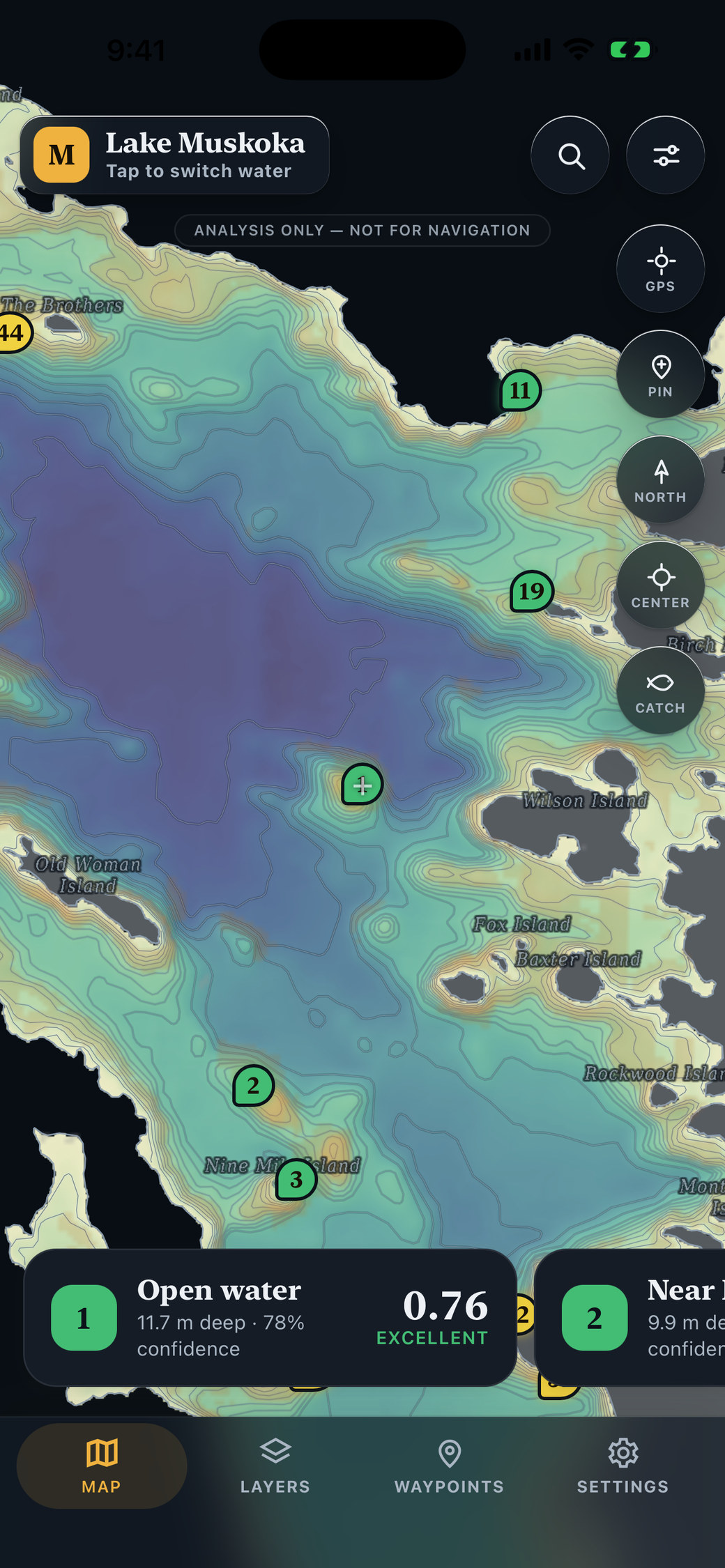
The model's picks are on the map

Three casts each. Who read the lake better?

0.00You
0.00The model

Get the app
Scroll
Why Anglers Edge

Every other app shows you a map. This one gives you an answer.

Depth charts leave the hard part to you: reading structure, wind, season and temperature together to decide where fish hold today. Anglers Edge does that reading — and then shows its work.

1

Scores, not just charts

An eleven-factor model rates every square of the lake for your species, season, date, wind and pressure, then ranks the best spots.

2

Shows its work

Tap any spot for a plain-language breakdown: which factors drove the score and by how much. No black box, ever.

3

Works where the fish are

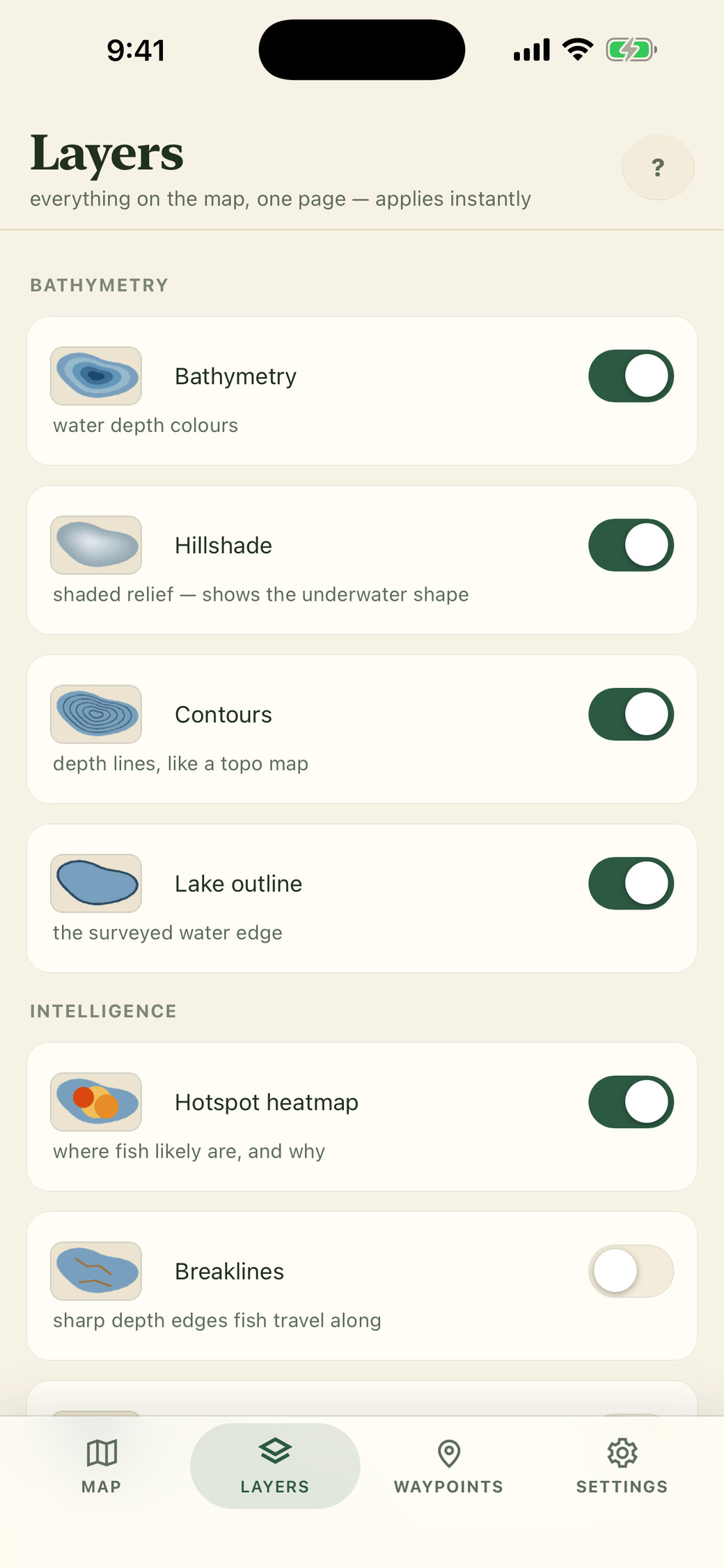
Maps, structure layers and the model ship inside the app. Zero signal, zero problem — it runs entirely on your phone.

How it scores a lake

Eleven things a great angler reads at once.

Each factor is weighted for the species and the season. Hard rules come first: unsurveyed water scores zero rather than guessing, and water below the oxygen limit is out.

Depth bandthe range they hold at right now
Breaks & ledgessteep drops fish travel along
Humpsunderwater hills — ambush points
Saddleslow crossings between humps
Pointsstructure jutting into the lake
Inside turnsbends in the contour that gather fish
Flatseven feeding shelves
Wind fetchwhere today's wind pushes bait
Bottom typerock, sand, muck or weed — satellite-measured where we can
Lightdawn, dusk and shade
Thermoclinethe temperature layer, modelled per lake
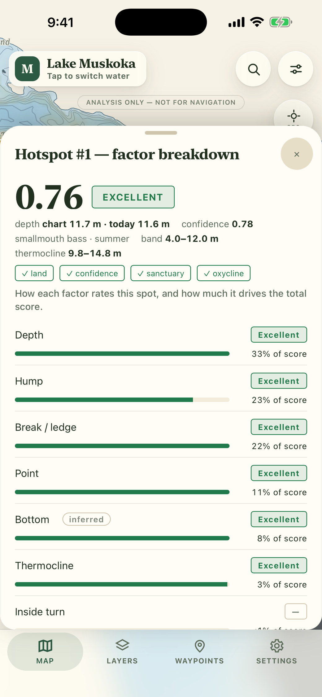
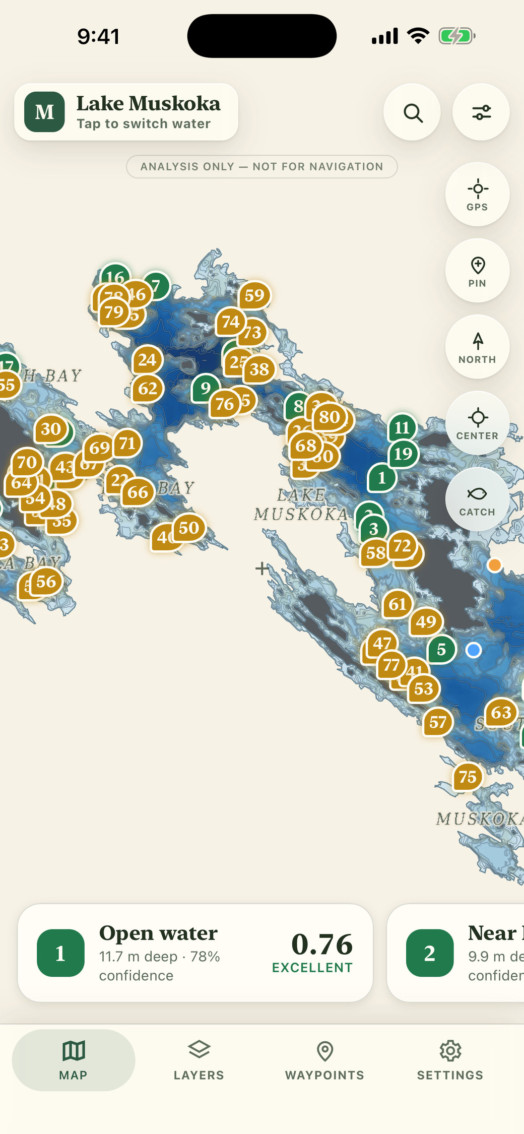
Anglers Edge spot breakdown: a 0.76 Excellent score with depth, hump, break and point factors explained
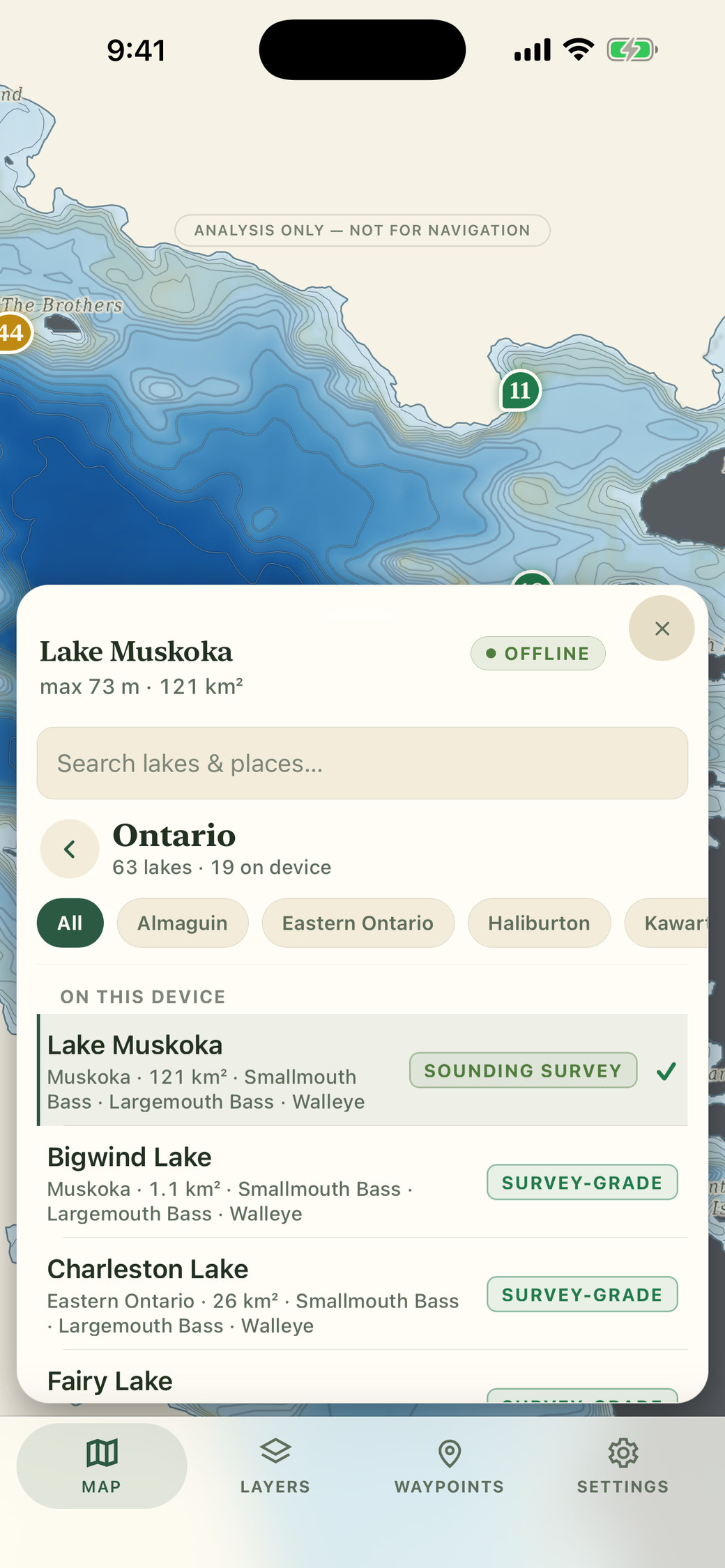
Anglers Edge lake switcher listing lakes by province and state with survey-grade data badges
Honest by design

We tell you what we know — and what we don't.

Bad data costs you a day on the water. So the app never pretends.

  • Unsurveyed water is marked, never guessed.
  • Measured versus inferred data is labelled everywhere.
  • Every lake publishes its survey year, sounding count and measured model error.
  • Your own sonar logs can improve your map — and are credited back to you.
  • Analysis only, not a navigation aid. It says so, in the app.
Pricing

Free stays free. We only ever sell more.

You've seen what happens when a fishing app locks the good stuff behind a monthly fee. We're not doing that — and we've written it down.

$0forever

Everything the app does, free.

  • The full scoring engine and every breakdown
  • 19 bundled lakes, more downloadable
  • GPS, tracks and waypoints
  • One-tap catch log
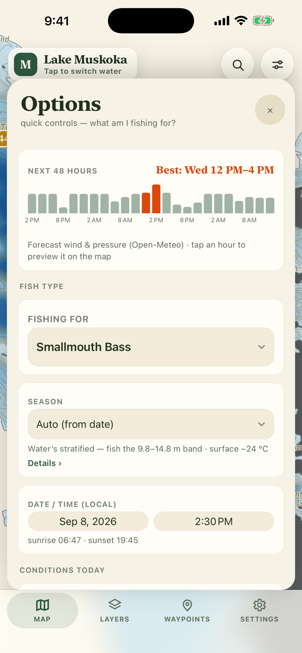
  • 48-hour bite window
  • No account. No ads. No tracking.
Want more water? Province & state packs unlock every lake we've mapped there — one-time, and you own it.
For brands, lodges & guides

Partners pay. Anglers don't.

  • The lure that works at this spot, in these conditions — labelled, useful, optional
  • Lodges and guides get packs of their own water to hand to guests
  • Never your data. Never required.
Talk to us
"Nothing that is free today will ever move behind a paywall."
Compare

Everyone has maps. Nobody has the answer.

Anglers EdgeFishbrainNavionicsonX Fish
Scores spots with a modelYesPaid tierNoNo
Explains whyYesNoNoNo
Works fully offlineYesNoPaid tierYes
Canadian lakesYesPartialYesNo
No account requiredYesNoNoNo
Core features freeYesNoNoNo
PriceFree · one-time province packs$10–13 / month~$50 / year$35 / year
A look inside

Built like a fieldbook, not a dashboard.

Lakes we cover

70 lakes, mapped and scored. More on the way.

Every lake ships with detailed bathymetry, structure layers and its own calibrated scoring model — from Muskoka and the Kawarthas to Temagami, the Northwest and Quebec's Eastern Townships. Each lake has its own page. Packs for the rest of Canada and the United States are in development.

See every lake by province and area → Don't see yours? Request it from inside the app — requests drive what we build next.

Questions

Straight answers.

Does it really work with no signal?

Yes. The lake maps, structure layers and the scoring model are all inside the app. The only things that need a connection are optional live weather and the 48-hour forecast — and the app tells you plainly when they're unavailable.

Which lakes?

Anglers Edge is a North American app: 19 lakes are built in, with 51 more downloadable free inside the app — 70 today across Ontario and Quebec, with lakes across the rest of Canada and the United States being built now, from Muskoka to Temagami — and packs are being built for the rest of Canada and the United States. Missing yours? Request it from inside the app.

Is it a navigation app?

No. Anglers Edge is an analysis tool. It never routes you anywhere and the source bathymetry is not navigation-grade. Carry official charts.

What do you collect about me?

Nothing. There's no account. Your location is used on your phone to show your position on the map and never leaves it. Waypoints and catches are stored on the device.

Will you paywall features later?

No. Nothing that is free today will ever move behind a paywall. If we ever add paid extras, they will only ever be things that didn't exist before.

Get the app

Your water, scored.

Free on the App Store. No account, no card, no catch.

Download on theApp Store